多普勒天气雷达站址视程的客观分析技术
AN OBJECTIVE METHOD FOR ANALYZING THE HORIZON OF DOPPLER WEATHER RADAR STATIONS
-
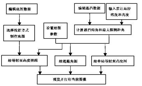
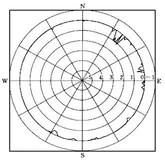
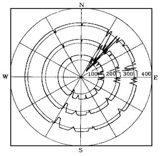
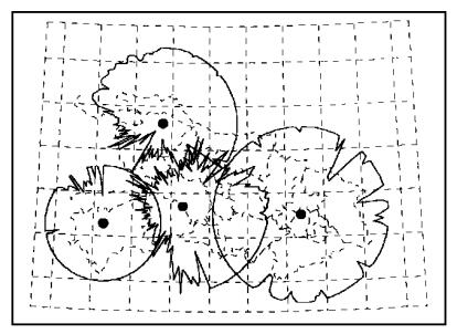
摘要: 开发了多普勒天气雷达候选站址视程的客观分析软件.该软件根据候选站及其四周一定范围内的地理信息, 十分快速地求算和自动绘制雷达单站的遮蔽角图、系列等射束高度图和多个雷达站Mercator或Lambert投影方式下的等射束高度拼图, 提供了分析和评价候选站雷达有效视程和相关雷达网共同覆盖效果以及定量应用雷达资料的客观工具.Abstract: A software for analyzing objectively the horizon of Doppler weather radar stations is developed. According to the geographic information of the selected radar station and its periphery, the software can calculate speedily and display automatically the barricaded elevation map as well as the range-azimuth distribution maps for different heights of a single radar station and the composite map for multiple radars under the Mercator or Lambert projection mode. It provides an objective tool to analyze and appraise the possible horizon of Doppler radars, the combined coverage effect of the conjoint radar network and the quantitative application of radar data.
-
Key words:
- Doppler radar station;
- Radar horizon;
- Objective analysis
-
表 1 最大探测距离与天线仰角的关系

-
[1] Bandalo S.An analytic method for radar horizon computation.In: Collier C G, ed.International Weather Radar Networking.Kluwer Academic Publishers, 1992.75~79. [2] 万玉发, 陈少林, 罗建国.数字化天气雷达联网拼图与卫星云图综合实时处理系统.气象, 1994, 20 (8): 26~31. http://www.cnki.com.cn/Article/CJFDTOTAL-QXXX199408005.htm [3] 胡毓钜, 龚剑文, 黄伟.地理投影, 北京:测绘出版社, 1981.40~41. [4] 万玉发, 陈少林, 罗建国, 等.雷达和卫星图像的坐标同化及其实现.南京气象学院学报, 1990, 13 (4): 638~643. http://www.cnki.com.cn/Article/CJFDTOTAL-NJQX199004028.htm -


 设为首页
设为首页 加入收藏
加入收藏


 下载:
下载:
