摘要:
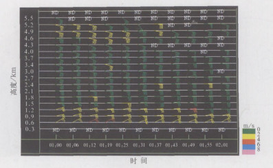
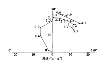
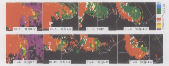
通过分析2004年8月25日发生在浙江省宁波市的一次台风前部龙卷发生发展的环境特征, 发现该龙卷发生在台风前部风切变区里, 尽管当时涡度、散度等物理量对于深对流发展不是非常有利, 但下湿中干、强的垂直风切变及地形条件等还是有利于局地弱龙卷的产生; 在宁波新一代天气雷达产品上表现为强的钩状回波, 速度场上有相邻的正负速度中心及强的组合切变值等。通过多个反射率产品、剖面产品等综合分析了该风暴的三维结构, 初步了解此类弱龙卷的发生机理, 为以后的预报提供一些经验。
Abstract:
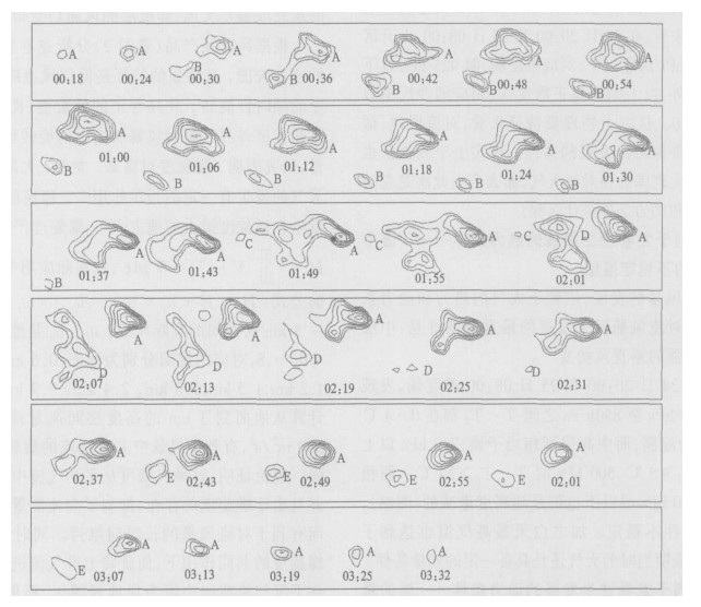
By employing the basic and derived data sets from the products of the new generation Doppler weather radar and the conventional weather observation data sets, a tornado event in front of a typhoon happened in Gaoqiao town, Zhejiang Province on 25 August, 2004 is synthetically analyzed. The results show that the intensity of this tornado belongs to the F1 tornado intensity category. And its generation and development has a close relationship with the strong wind shear in front of the typhoon. The vertical humidity change (greater in the lower level and less in the upper level), the significant wind vertical shear and the topographic impact play an important role in the occurrence of the local tornado, though the vorticity and the divergence patterns may not be very essential for the deep convective development. The analysis of the Doppler weather radar output products also indicates that the storm has a life span lasting for more than 3 hours, with its echo top extends the height of less than 6 km. And the tornado locates on the edge of the strongest echo gradient region near the V-shaped weak echo region which means that the strong updraft contributes most to the tornado. It can be discovered that quite a few radar products can help show the occurrence of the typhoon, such as the significant hook echo pattern with 60 dBz reflectivity intensity, microcyclone characteristic in the products of storm-relative mean radial velocity map in all four volume scans, with a maximum composite shear approaching to 189×10-3 s-1 and so on. But the warning time is only twelve minutes in advance of the occurrence of the tornado and the weak microcyclone has a several-kilometer scale in the vertical direction. Moreover the analysis of the 3-dimentional characteristic of the tornado reveals that the tornado is neither a typical supercell tornado nor a non-supercell one, it is a mixed tornado of the above two kinds. The tornado may develop while a vortex meets with the cyclonic region resulting from the wind vertical shear and the ascending area coming from the convergence effect and rotates acceleratedly. The tornado develops in the edge of the local vortex source in front of the downdraft while the rotation and updraft enhance owing to the great wind vertical shear and the effects of the buoyancy and the helicity. Therefore, the analysis is condutive to the tornado forecast in the future.


 设为首页
设为首页 加入收藏
加入收藏


 下载:
下载:


